- ENDEES
- UiU - Home
- Art Destination Jordania
- AD Jordania
- DESTACADOS
- TEMAS
- ITINERARIOS
- Recomendaciones de viaje
- Newsletter gratuito
- UiU - Sections
- Newsletter gratuito
Para la mejor vista de nuestra página web, use su dispositivo en forma horizontal.
Las calles columnadas de Gerasa se encuentran entre las mejor conservadas de Oriente Próximo. Aunque su disposición se aparta del estricto esquema grecorromano, se utilizan las denominaciones habituales de los ejes principales: Cardo para la conexión central norte-sur y Decumanus para las dos grandes calles transversales que cruzan el Cardo en ángulo recto por el sur y el norte.
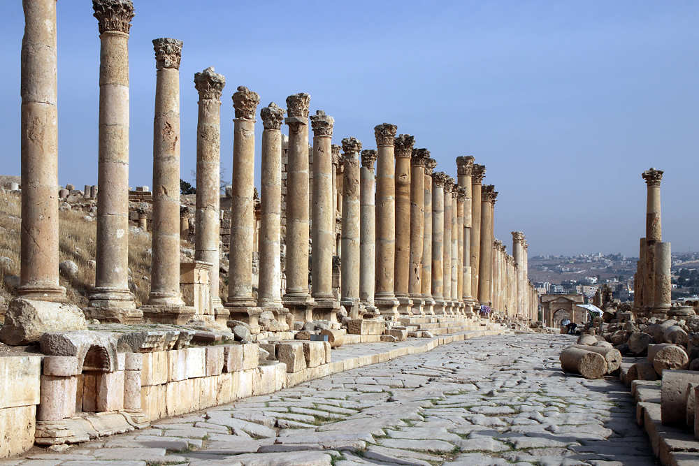
Hasta principios del siglo II d.C., el trazado de las calles de Gerasa se basaba en el relieve y las vías de circulación que se desarrollaron con el transcurso del tiempo. Su expansión y reconstrucción de forma planificada recién comenzó cuando la ciudad pasó a formar parte de la Provincia Arabia, fundada por el Imperio Romano tras la anexión del Imperio Nabateo en el año 106 d.C. bajo el emperador Trajano. A partir de allí, en la medida de lo posible, la antigua red de calles se sustituyó por una retícula ortogonal. (J. Seigne, p. 12)
El Cardo, de 800 m de longitud, no discurre exactamente de norte a sur, como era habitual en el esquema hipodámico, sino ligeramente desplazado hacia el norte-noreste a causa del Chrysorhoas (río del Oro, hoy Wadi Jerash). Se fue convirtiendo gradualmente en una vía procesional y comercial representativa que conducía por las colinas, en parte escarpadas, del lado oeste del valle del río desde la Puerta Norte en línea recta hasta la Plaza Ovalada y, a través de ella, hasta el Santuario de Zeus Olímpico, el lugar de culto más importante de Gerasa en aquella época (véase también Plaza Ovalada).
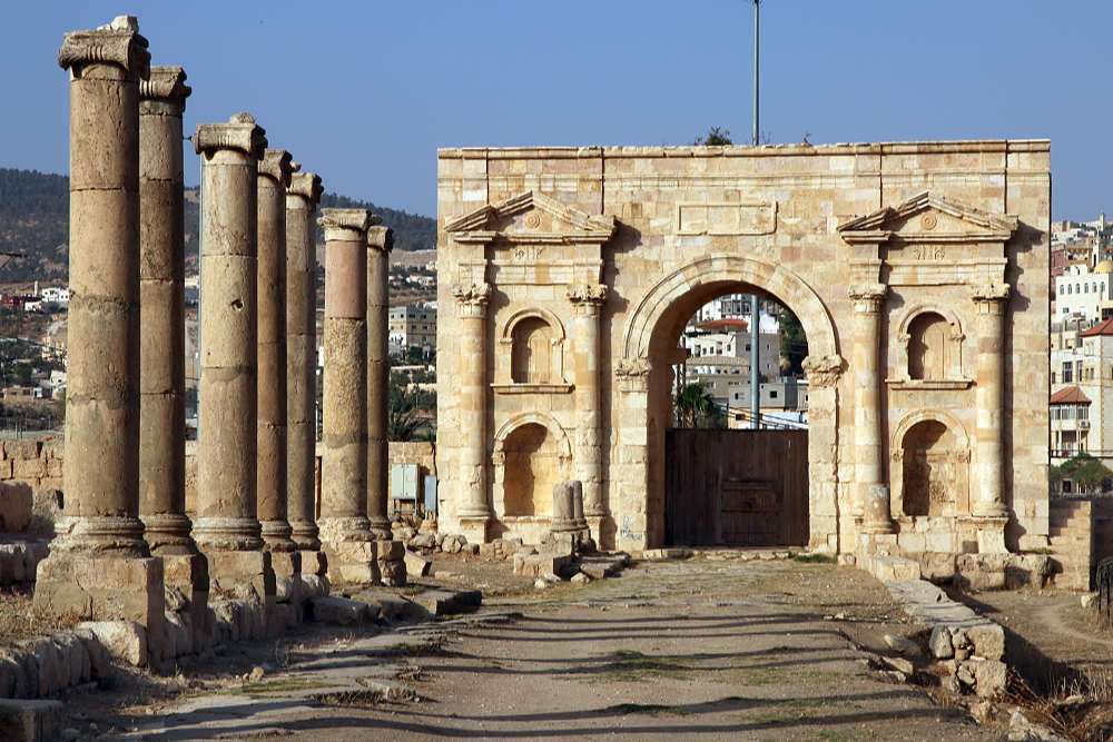
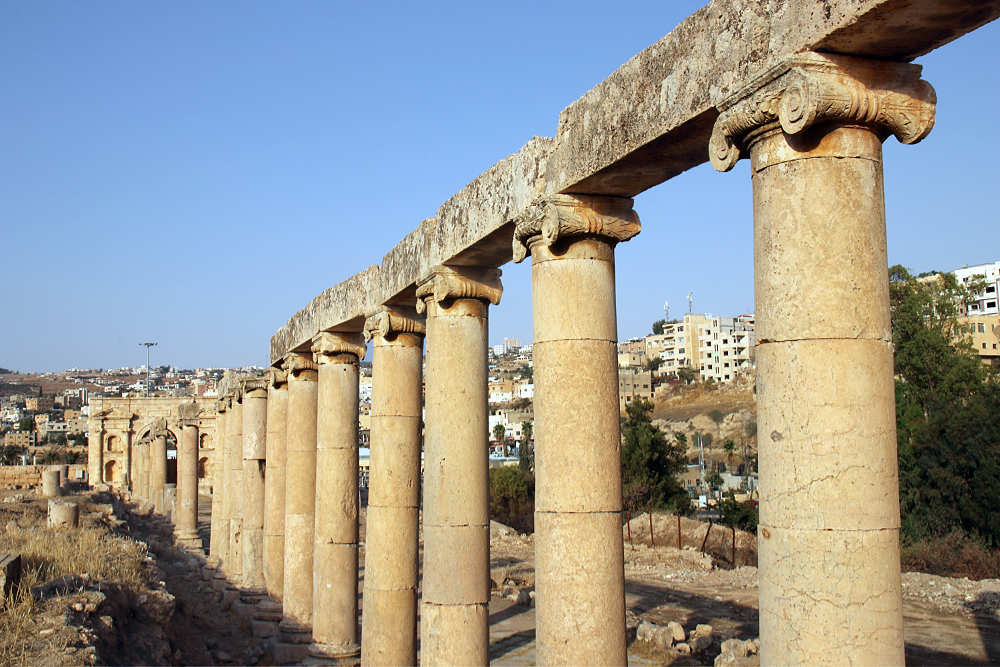
El Portal Norte está fechadao en el año 115 d.C. por una inscripción dedicatoria que nombra al emperador Trajano como fundador y salvador de la ciudad. Desde aquí partían importantes rutas comerciales hacia Pella, Escitópolis, Gadara y el Mediterráneo..
La sección norte del Cardo, frente al Portal Norte, es la más antigua. Fue construido en época trajano-hadriana (Trajano reinó hasta 117, Adriano hasta 138), y sus columnas tienen capiteles jónicos muy parecidos a los de la Plaza Ovalada, más o menos contemporánea (véanse los capiteles de la Plaza Ovalada).
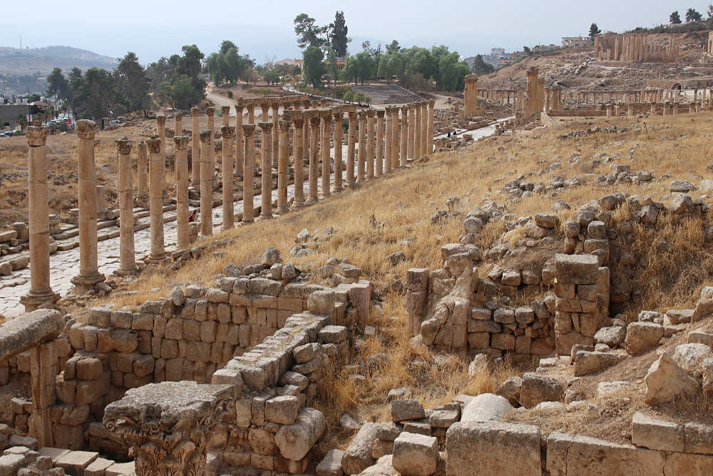
El Cardo Sur. A la derecha, en el fondo, la Plaza Ovalada y el Santuario de Zeus Olympios. Al fondo, a la izquierda, la llamada colina Camp Hill, donde se encontraba el núcleo de asentamiento más antiguo de Gerasa y donde actualmente se alza el museo.
La datación de las distintas fases de construcción y reconstrucción del Cardo se ve facilitada por una serie de inscripciones con dedicatorias, consagraciones y nombres de donantes. Más información en los respectivos monumentos.
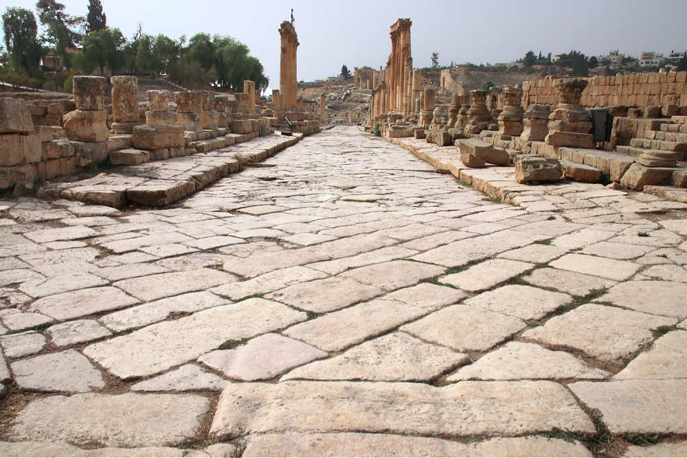
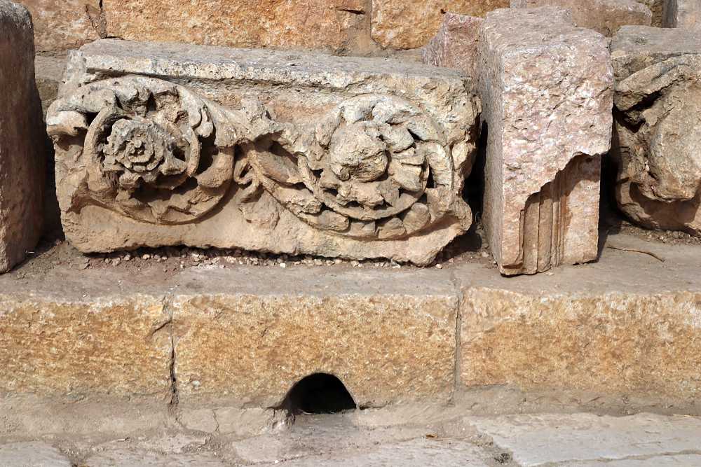
El cardo está pavimentado con losas rectangulares colocadas en diagonal, lo que reducía el riesgo de que las ruedas de los carros desgastaran las juntas. A intervalos irregulares, el pavimento se interrumpe con losas colocadas transversalmente, como puede verse en la foto de la izquierda con los surcos de las ruedas en primer plano. El ancho de la calzada varía en diferentes tramos entre 6,20 m y 7,60 m. Hay aceras ligeramente elevadas a ambos lados de la calzada y agujeros de drenaje en algunos puntos. Aproximadamente 1 m por debajo del pavimento discurre la canalización principal, la cloaca maxima.
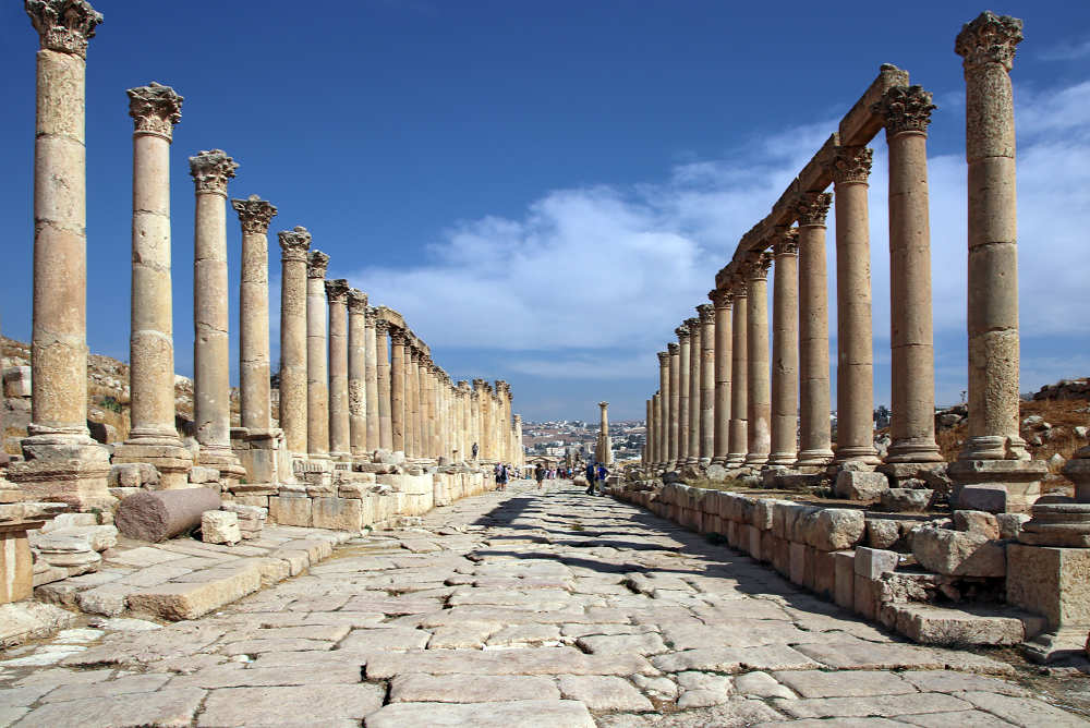
Las columnas, capiteles, arquitrabes y basamentos de los pórticos de las calles son de piedra caliza. A lo largo de las calles porticadas, especialmente alrededor de edificios públicos e intersecciones, había tiendas situadas en la parte trasera de los pórticos.
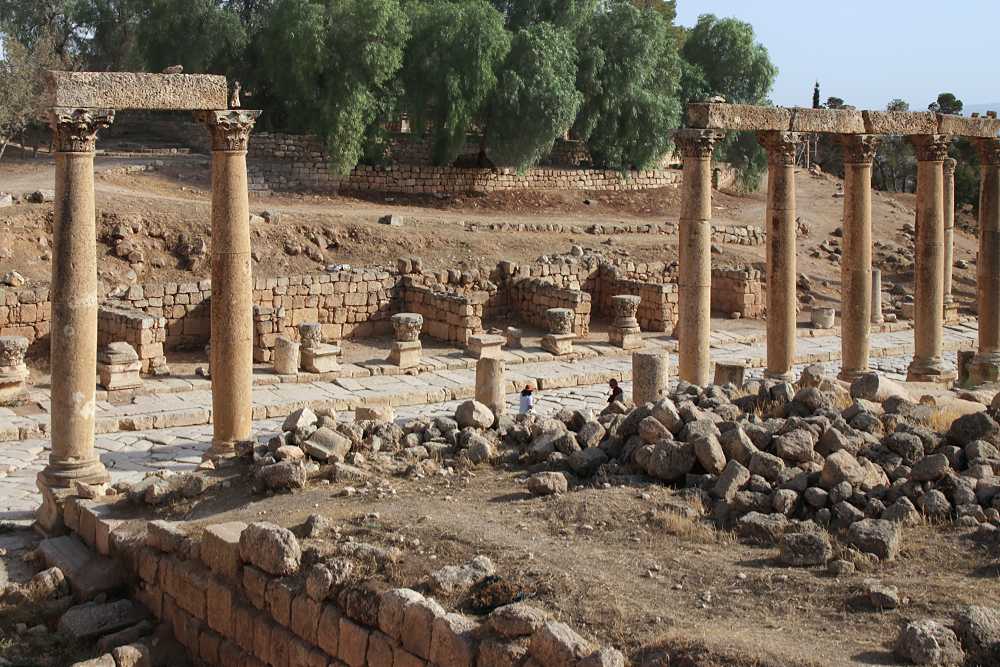
Tiendas sobre el Cardo
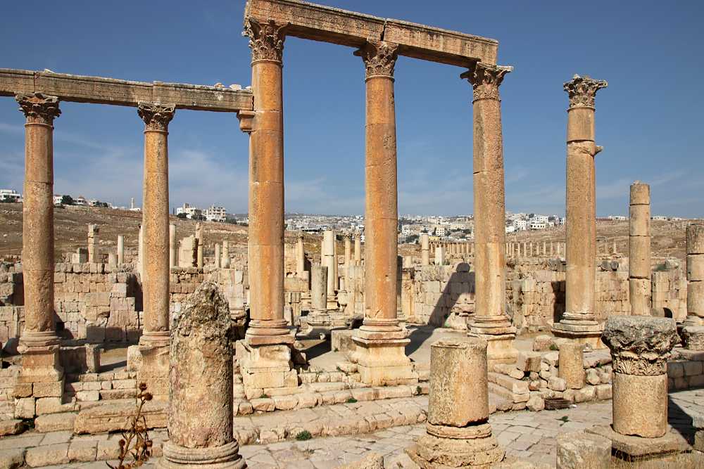
Columnas elevadas frente al Macellum
Los intercolumnios (distancia entre las columnas) varían en las distintas secciones. La altura de las columnas también varía mucho, desde poco más de 5 m en el Cardo norte hasta los Propileos de Artemisa, que tienen unos 16 m de altura. Las columnas elevadas se utilizaban para resaltar las entradas a edificios públicos importantes; por ejemplo, las situadas frente al Macellum tienen unos 10 m de altura y las de la izquierda, 7,20 m.
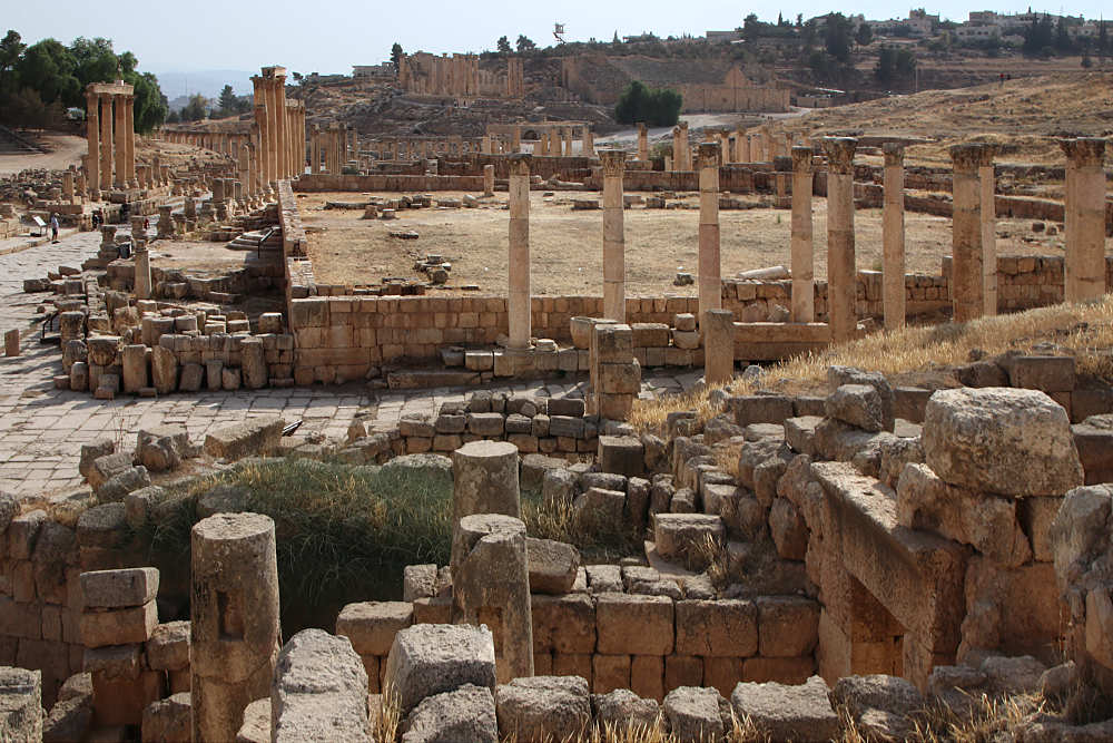
En la intersección del Cardo con el Decumanus Sur se descubrieron los cimientos de una mezquita.
Con la victoria del ejército musulmán en la batalla de Yarmuk en 636, la era bizantina o romana oriental terminó en Transjordania y comenzó la era islámica. Gerasa no quedó muy destruida durante las conquistas, pero la ciudad sufrió mucho a causa de una epidemia de peste.
Cuando comenzó el gobierno de la dinastía Omeya (661- 750) en la región, al principio la mayoría de la población seguía siendo cristiana, por lo que se siguieron utilizando muchas iglesias. Sin embargo, poco a poco más habitantes se convirtieron al Islam y la ciudad fue necesitando mezquitas. Esta mezquita se construyó en la primera mitad del siglo VIII, probablemente bajo el califa Hisham, hijo de Abd al-Malik (724/743 d. C.), en el emplazamiento de una villa romana anterior. Constaba de un patio abierto con pórticos en tres lados y una gran sala de oración (39 x 14 m) dividida en tres naves por dos filas de columnas.
(De informaciones en el sitio)
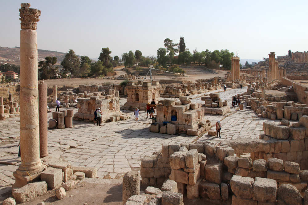
La intersección del Cardo con el Decumanus Sur fue ampliada hasta formar una plaza circular (de unos 44 m de diámetro) con un Tetrakionion en el centro. Como se puede ver en el dibujo (de un cartel en el sitio) a continuación, es una estructura hecha de cuatro pedestales independientes, cada uno con 4 columnas sobre el mismo.
El monumento data de la época de la Tetrarquía, entre 293 y 305 d.C., cuando el Imperio Romano estaba gobernado por cuatro emperadores de igual poder. Según la información que se encuentra en el sitio, se supone que en los pedestales había estatuas de los tetrarcas Diocleciano, Maximiano Hercúleo, Constancio Cloro y Galerio. En los dos pedestales orientales (los dos de la izquierda en la foto) se han conservado dedicatorias en latín para dos de los tetrarcas romanos: una para Constancio y la otra para Maximiano o Galerio.
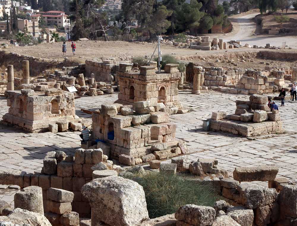
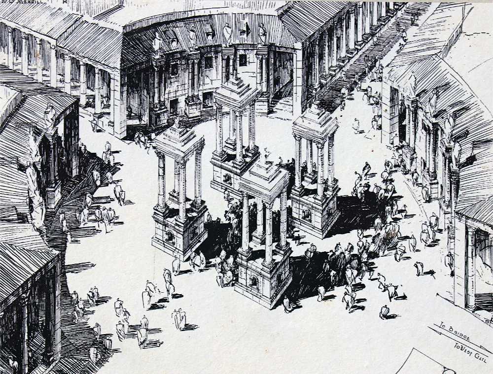
(Dibujo de reconstrucción a partir de una información en el sitio, publicado originalmente en Kraeling, Plan XV)
Los pedestales individuales con un nicho a cada lado tienen una longitud de borde de 4 m y están separados entre sí por 6 m. Originalmente, cada pedestal sostenía cuatro columnas de granito rosa de Asuán (Egipto), coronadas por un entablamento.
El cuarto de círculo perimetral de la plaza, interrumpido por las calles porticadas, albergaba tiendas. Delante de cada una de las fachadas, adaptadas a la curvatura, había dos medias columnas con capiteles corintios sobre un alto pedestal.
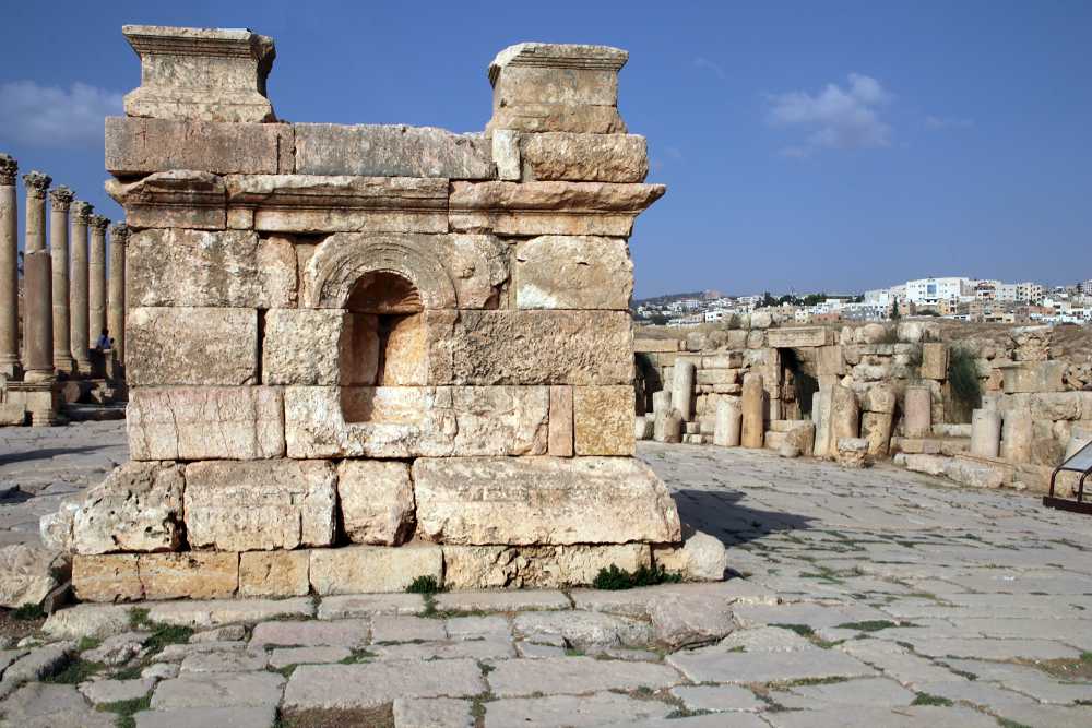
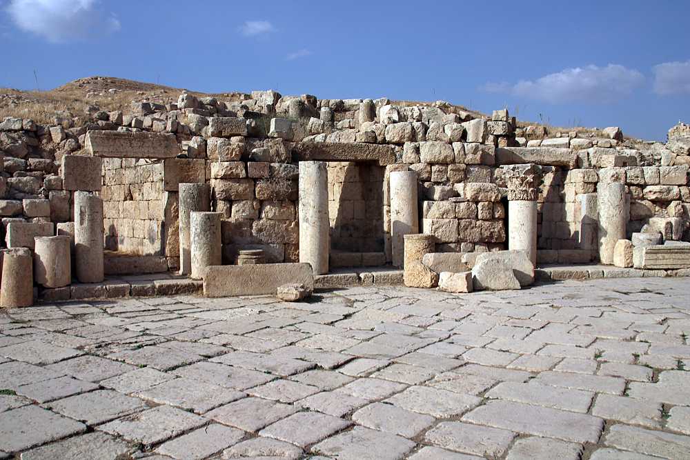
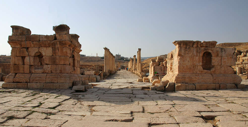
Vista desde el Tetrakionion en dirección oeste hacia el Decumanus Sur.
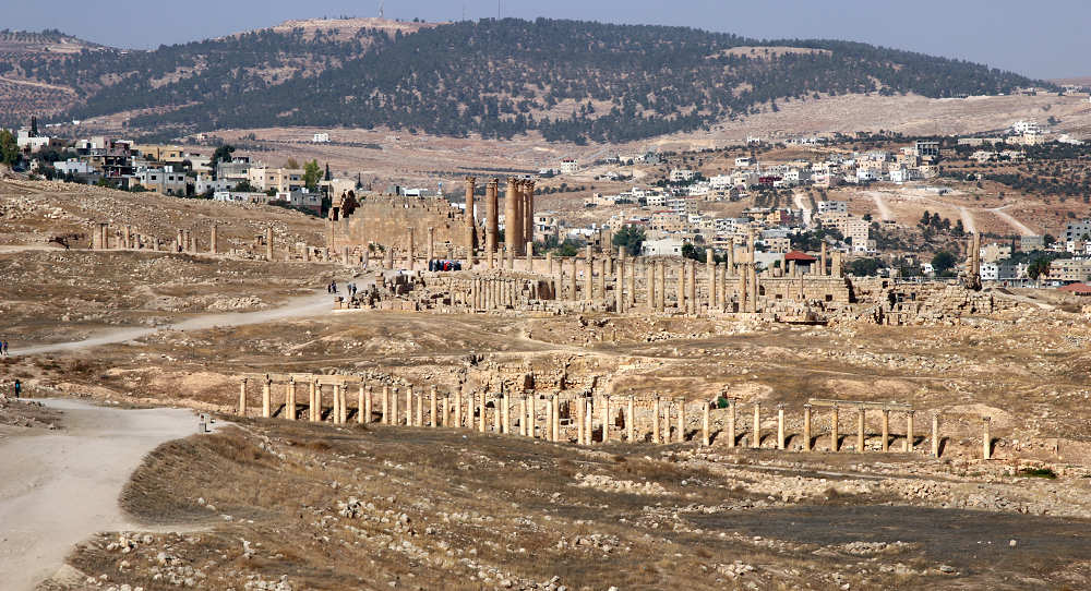
En la foto se ve en primer plano la sección occidental del Decumanus Sur con las casas del periodo omeya. Las columnas un poco más atrás pertenecen a la Iglesia de San Teodoro. Las altísimas columnas forman parte del Templo de Artemisa.
El Decumanus Sur, la segunda vía columnada más grande de Gerasa, cruza el Cardo en dirección oeste-este en ángulo recto. Tiene unos 620 m de longitud, su calzada tenía 7 m de ancho, carecía de aceras y los pórticos estaban formados por columnas de unos 6 m de altura con capiteles corintios.
Los arqueólogos encontraron restos de casas y cisternas de los siglos I y II d.C. en el Decumanus Sur, que fueron destruidas para la construcción de la nueva calzada, alrededor del año 165 d.C.. Por tanto, la nueva construcción no pudo iniciarse hasta después, hacia 170 d.C. Una inscripción en una columna cerca del puente sobre el Chrysorhoas indica que los empedrados se colocaron en el siglo III. El Decumanus Sur nunca se terminó del todo, porque no cruzaba toda el área de la ciudad.
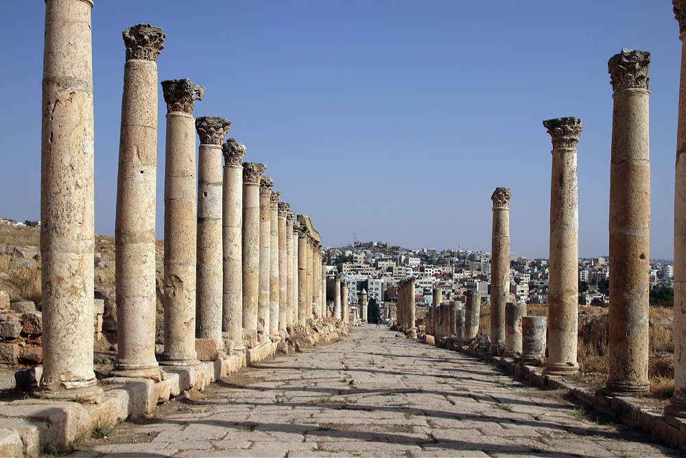
En la foto de arriba se ve una torre al final del camino. Se trata del minarete de la mezquita situada al otro lado del wadi Jerash. El Decumanus Sur era una de las dos calzadas que cruzaban el río y conectaban los barrios de ambas orillas.
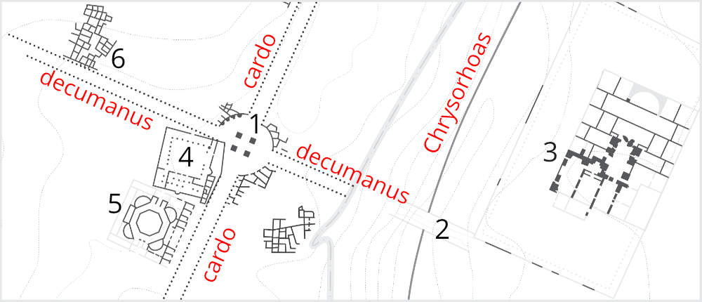
1 - Tetrakionion, 2 - Puente sobre el Chrysorhoas (Río dorado, hoy día Wadi Jerash), 3 - Grandes Baños Orientales, 4 - Mezquita, 5 - Macellum, 6 - Casas del período Omeya
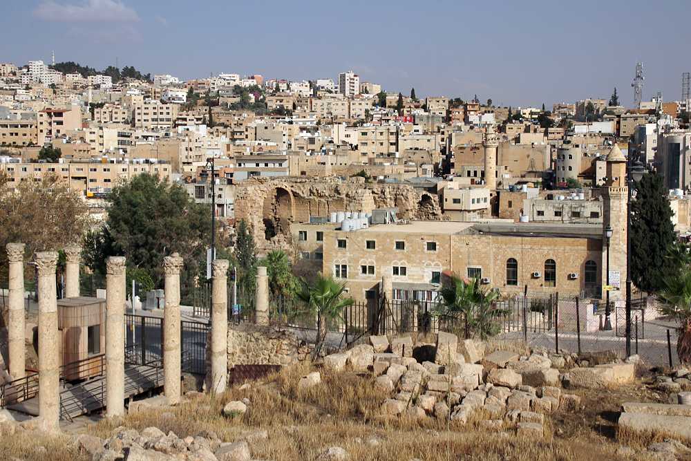
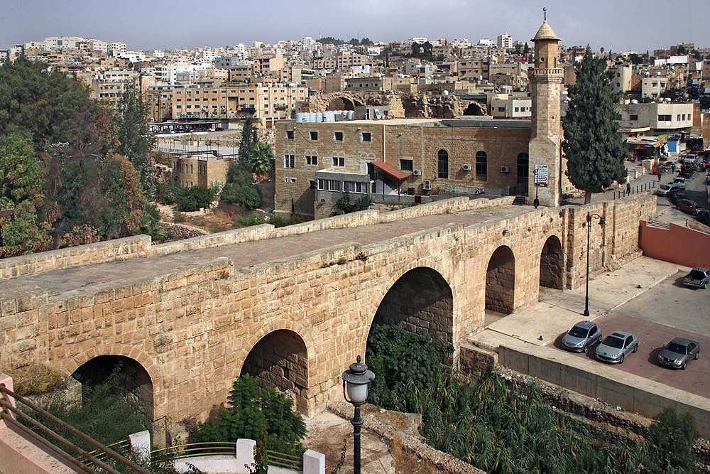
Las columnas de la primera foto pertenecen al Decumanus Sur, que continuaba por el puente que cruza el Chrysorhoas hacia la parte oriental de la ciudad. Hoy en día está interrumpido por una valla y una carretera moderna muy transitada. Pero el paseo por el exterior del sitio arqueológico y por el puente reconstruido merece la pena, porque al otro lado se pueden visitar las ruinas de las Grandes Baños Orientales, uno de los complejos termales más grandes y mejor conservados del antiguo Oriente.
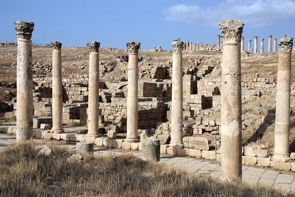
En el lado norte del Decumanus Sur se descubrieron restos de edificios residenciales que datan de la dominación Omeya (661- 750). Es "uno de los pocos complejos residenciales islámicos tempranos que se conservan y probablemente el más completo conocido hasta la fecha en Jordania". (The Umayyads, p. 149) Se construyó en el lugar de un barrio residencial de las épocas romana y bizantina que fue demolido para ello, principalmente con sus piedras recicladas y sobre los antiguos cimientos.
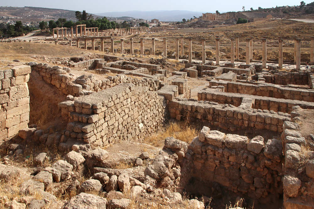
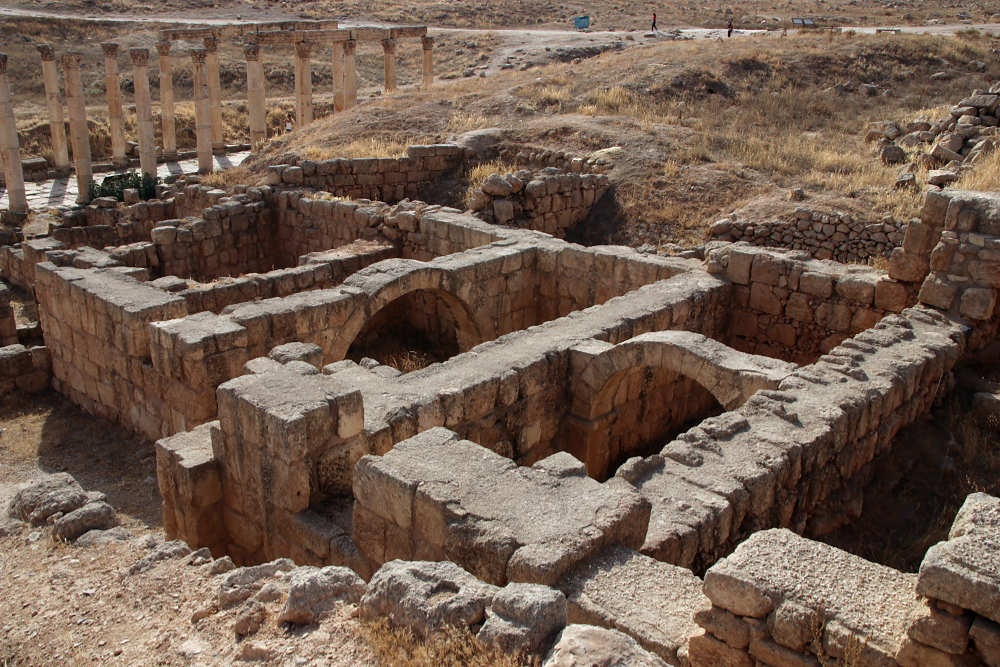
Una gran casa omeya datada en el año 660 medía unos 13 x 21 m, tenía la entrada principal en el Decumanus, una superficie habitable de 200 metros cuadrados y las dependencias habituales (cocina, almacenes). A las estancias inferiores se accedía a través de puertas desde el patio. Las habitaciones más grandes estaban divididas por un arco en el centro, una característica de la construcción islámica que se encuentra hasta hoy en casas sencillas del siglo XIX en algunos pueblos. Probablemente había una planta superior, accesible desde el patio por escaleras. El sistema de alcantarillado subterráneo estaba conectado al del exterior urbano y, al parecer, databa de la época romana.
En el siglo VIII, la gran casa se dividió en unidades más pequeñas. Probablemente tras un terremoto, alfareros operaron brevemente cuatro hornos en el lugar.
(De informaciones en el sitio y en The Umayyads, pp. 149-151).
(© Texto de Universes in Universe a partir de información de distintas fuentes.)
Cardo, Mezquita Omeya / Abasí, Tetrakionion, Decumanus Sur, casas omeyas
Ciudad arqueológica de Jerash
Ubicación en el mapa
© Textos y fotos protegidos por derechos de autor.
Recopilación de información, edición, traducciones, fotos: Universes in Universe, excepto se indique en especial.
Gerasa, City of the Decapolis.
An account embodying the record of a joint excavation conducted by Yale University and the British School of Archaeology in Jerusalem (1928-1930), and Yale University and the American schools of Oriental Research (1930-1931, 1933-1934).
New Haven, American Schools of Oriental Research, 1938.